This route is divided into three differenciated parts:
- From Dénia to Xàbia by the sea or by roads bordering the sea
- Going through Xàbia cala to cala
- Paths along the cliffs of El Poble de Benitatxell
From Dénia to Xàbia:
The main part of this proposal is to have first-hand experience and be in direct contact with the sea and the coast of Dénia up to the Cova Tallada.
The route can be done by following a signposted path from the end of Las Rotas area to the cave itself. It is advisable to wear comfortable waterproof shoes for the last part of the route.
In Summer a previous appointment is necessary on this website: http://www.denia.net/cova-tallada5
Desde la Cova Tallada se inicia una senda que sube a la zona de las Planas de Xàbia y de ahí se accede a un mirador a toda la bahía de Xàbia, desde donde se inicia una senda que permite llegar al puerto de Xàbia.
The other part of this proposal consists of taking a boat from the port of Dénia and making the trip to Xàbia while you admire the rocky area of Las Rotas, the Cova Tallada and then the cape of San Antonio. The trip ends in the port of Xàbia.
Existe la posibilidad de volver de nuevo a Dénia o continuar la ruta hacia las calas de Xàbia. El barco permite llevar bicicletas por ello pueden hacerse el siguiente tramo de la ruta en bicicleta. Se pueden consultar los horarios en https://www.mundomarino.es
Going through Xàbia Cala to Cala
You can do this part of the route by normal or electrical bicycles and will lead you through the entire coastline of Xàbia.
The route starts in the Port of Xàbia, where you will enjoy a rocky beach with crystal clear waters: La Grava. It is a urban beach surrounded by all kinds of services offering the user a convenient option to enjoy the sea.
Next, a few metres away by bike, you will find the 2 km long beach of Primer Muntanyar. This is a semi-urban and open area of gravel and rock that stretches from the mouth of the Gorgos river to the Arenal beach.
On its southern slope there is a large excavated pool, known as Baños de la Reina. This area was a commercial settlement in the second half of the 1st century BC, where salted fish and fish sauce were produced.
The Parador de Turismo of Xàbia marks the boundary between the gravel and rocks of Primer Muntanyar and El Arenal, an urban beach located right on the seafront promenade where you can enjoy a wide range of services.
Behind the Arenal beach you can begin a route through the unspoilt and scenic calas, whose access is however more difficult. These are the beaches of the Segon Muntanyar with 1 km 700 m length, semi-urban and open rocky spaces to the south of the Arenal beach, made up of a rocky coastline of "tosca" (stone formed by fossilised sand).
Just next to the "Segon Muntanyar" there are two small calas connected by a stone coastline:
Caleta I: Rustic cala of gravel and rock located at the end of Ultramar Avenue. Access is still recommended by bicycle and the last stretch is along a small promenade of about 100 metres. From here you can access the Cala Blanca viewpoint. It is approximately 80 m long.
Caleta II: Rustic cala of gravel, pebbles and rock. It is characterised by its rough stone arm that acts as a barrier in the sea, so its waters are usually calm and crystalline. It can be reached on foot from Caleta I. It can also be accessed from the Mirador De Les Caletes viewpoint taking some stairs. It is approximately 40 m long.
The route now continues with the longest stretch by cycling until reaching the next cala, the Cala Sardinera. This is a small unspoilt cala of gravel and pebbles located on the northern slope of Cap Prim or Sant Martí. Access to this cala is on foot from the Mirador de la Cruz del Portitxol viewpoint, along a path that runs alongside genuine unspoilt nature. It used to be the best place for sardines, fine nets that were employed twice a day (at sunrise and sunset respectively). Hence the origin of its name. It is 200 m long.
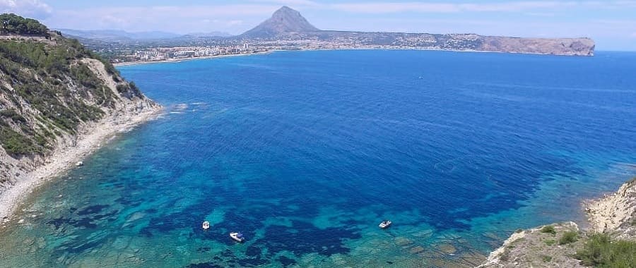
To continue the route we will return to the Portitxol Cross viewpoint and continue in the direction of Cabo de la Nao. The next cala to visit is Barraca or Portixol. It is a rustic cove of gravel, pebbles and rock located between Cap Prim and Cap Negre. Opposite the cove, we find Portitxol Island (300 metres), a place of great botanical and archaeological interest and it is highly recommended for scuba diving. It is 900 m long.
The route will finish in the Cala Granadella, an ideal rustic cala for snorkel or diving thanks to its crystal waters. It is located in the south of Xàbia. It will be accessed through a road with the same name, which must be taken from the road Cabo de la Nao, approximately 2 km before reaching it. From the same road of La Granadella you can access the viewpoint. At the car park of the cala the hiking route of Castell de la Granadella begins. It is 160 m long.
Hiking from the Cala Moraig to the Cala Llebeig in El Poble Nou de Benitatxell
This section of the route is part of the SL-CV50. From Cala Moraig to Cala Llebeig there is a distance of 2 km and from Cala Moraig to Barranc de la Viuda there is a distance of 3.4 km.
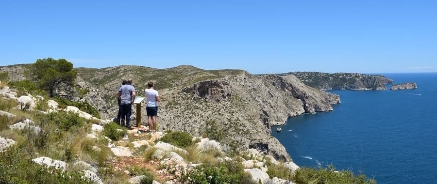
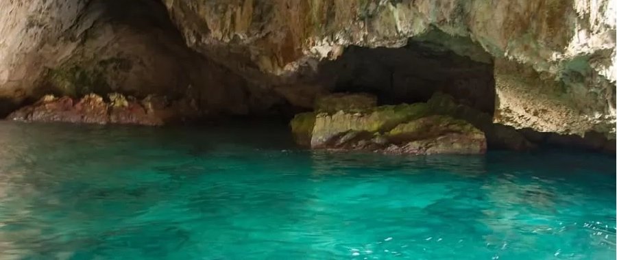
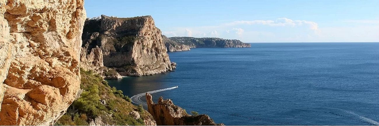
The start is from the top of the road that goes down to the Cala Moraig. From there you can access a waymarked path where the route allows you to enjoy the magnificent views, native vegetation as well as visit small caves used in the past by fishermen.
The vertical wall provides a full perspective of the horizon with spectacular views of the Mediterranean Sea. The path reaches Llebeig Cove, from here, you can continue the route along the Barranc de la Viuda ravine, in the municipality of Teulada-Moraira.


 Boat
Boat  On foot
 Car
Car Bike
Bike