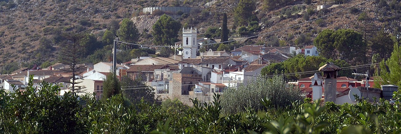
Sanet y Negrals is one of the five villages that make up the Rectoría sub-region. It is located on the slopes of the Sierra de Segaria, at an altitude of 83 metres, with a mild climate and 10 km from the beach. It covers an area of 3.94 km2 and has a population of 648 inhabitants.2 and has 648 inhabitants.
Although the municipality of Sanet is quite late, there is evidence of human settlements from very early times. At the top of the Segaria mountain range there are remains of an ancient Iberian settlementfrom the 6th century BC., which was probably Edetan. The first historical data are found in the 16th century. In this age there was a large manor house commonly known as “La Señoria”, which belonged to a feudal lord.This palace was surrounded by a few houses that constituted the place of Negrals and were inhabited by Moorish who lived on the surrounding lands. The village was acquired in 1570 by Sir Lorenzo Merita and his wife Andrea Gisbert, the first feudal lords who know the municipality’s history. Later in the western part of Negrals another hamlet called Sanet was built, also occupied by Moorish farmers.
After the expulsion of the Moorish in 1646, Sanet as well as Negrals were repopulated by families from a Balearic origin and coming from Mallorca to get in charge of the farmlands.
Sanet and Negrals were initially separated, each forming their own municipality, even after the town charters were granted during the reign of Philip III. In 1820 they were united into a single town called Unión Legal. In 1823 they separated for political reasons and in 1834 they were definitively united by order of Isabel II, forming a municipality called Sanet y Negrals.
Some remarkable places to visit are the Iglesia de Santa Ana, the Palau de la Señoria, La Magnolia (a centenary tree) and the Plaza del Cristo.